Monitor Your Metocean Data

Real-time insights for maritime operations and offshore installations.
Comprehensive meteorological and oceanographic monitoring solutions for maritime operations, offshore installations, and coastal management.
Comprehensive monitoring of critical meteorological and oceanographic conditions

Key Metocean Parameters

Wind Conditions

  • Wind speed and direction
  • Gust measurements
  • Wind statistics
  • Historical patterns

Wave Analysis

  • Wave height and period
  • Wave direction
  • Spectral analysis
  • Storm monitoring

Weather Data

  • Temperature profiles
  • Precipitation rates
  • Atmospheric pressure
  • Visibility conditions

Ocean Currents

  • Current velocity
  • Direction tracking
  • Depth profiles
  • Tidal influences
End-to-end metocean monitoring systems for maritime operations

Comprehensive Monitoring Solutions

  • Advanced sensor networks
  • Satellite data integration
  • Real-time buoy systems
  • Automated weather stations
  • Remote sensing platforms
  • Continuous monitoring
  • Real-time data processing
  • Advanced visualization
  • Predictive analytics
  • Custom report generation
  • Historical data analysis
  • Trend identification
  • Offshore operations
  • Port management
  • Route optimization
  • Safety monitoring
  • Environmental compliance
  • Risk assessment
Real-world applications of metocean monitoring

Maritime Applications

Offshore Operations

  • Wind farm installations
  • Marine construction
  • Port management
  • Vessel operations

Environmental Monitoring

  • Weather pattern analysis
  • Ocean condition tracking
  • Environmental compliance
  • Risk assessment
Industry-leading monitoring solutions

Why Choose Our Metocean Solutions

Operational Excellence

Enhanced Planning

Accurate weather window predictions for optimal operations

Reduced Downtime

Minimize weather-related interruptions through precise forecasting

Enhanced Safety

Real-time monitoring for improved operational safety

Technical Advantages

Advanced Validation

Robust data validation and quality control processes

Seamless Integration

Comprehensive integration with existing systems

Scalable Infrastructure

Flexible infrastructure that grows with your needs

Frequently Asked Questions

Still have questions?

Contact us! We’ll be happy to help you.

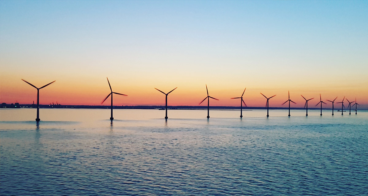
Metocean is a compound word combining "meteorological" and "oceanographic." It refers to the combined study and analysis of both weather (atmospheric) conditions and oceanographic factors such as waves, currents, and water properties that affect maritime operations and structures.

A Metocean report is a comprehensive document that provides detailed analysis of meteorological and oceanographic conditions for a specific location or region. It typically includes data on wind patterns, wave conditions, currents, water levels, and other environmental parameters, along with statistical analyses and operational recommendations.

A metocean buoy is a floating device equipped with various sensors and instruments that measure both meteorological and oceanographic parameters. These buoys collect real-time data on conditions such as wave height, wind speed, air and water temperature, current velocity, and other environmental factors crucial for maritime operations.

Ready to Start Monitoring?

Get access to comprehensive metocean monitoring solutions tailored to your needs.

Understanding Metocean Data

The Importance of Metocean Data

Metocean data plays a vital role in the planning and execution of offshore operations. It helps determine optimal weather windows for activities like construction, maintenance, and vessel operations. This data is particularly crucial for the renewable energy sector, especially in offshore wind farm development and operations.
The collection and analysis of metocean data have become increasingly sophisticated with technological advancements. Modern monitoring systems can provide highly accurate measurements of various parameters, enabling better decision-making and risk management in maritime operations.

Data Collection Methods

The collection of metocean data involves various sophisticated methods and technologies. Satellite observations provide broad coverage of ocean conditions, while in-situ measurements offer detailed, location-specific data. Wave radar systems can measure surface currents and wave fields over large areas.
Long-term monitoring programs are essential for understanding seasonal variations and establishing reliable baseline conditions. These programs often combine multiple data collection methods to ensure comprehensive coverage and data reliability.

Applications in Maritime Industry

The maritime industry relies heavily on metocean data for various applications. Shipping companies use this information for route planning and optimization, while offshore energy operators depend on it for installation and maintenance scheduling. Port authorities utilize metocean data for managing vessel traffic and ensuring safe harbor operations.
Environmental impact assessments also benefit from metocean data, as it helps understand how maritime activities might affect local ecosystems. This information is crucial for maintaining compliance with environmental regulations and developing sustainable maritime practices.

Future Developments

The field of metocean monitoring continues to evolve with technological advancements. Machine learning and artificial intelligence are increasingly being used to improve data analysis and forecasting capabilities. These technologies help identify patterns and trends that might not be apparent through traditional analysis methods.
Integration of various data sources and improved modeling techniques are leading to more accurate predictions of meteorological and oceanographic conditions. This enhanced accuracy is particularly valuable for long-term planning and risk assessment in maritime operations.

Quality Control and Data Management

Ensuring the quality and reliability of metocean data requires robust quality control procedures. This includes regular calibration of instruments, validation of measurements against multiple sources, and careful documentation of data collection methods. Data management systems must be capable of handling large volumes of information while maintaining accessibility and security.
The standardization of data formats and reporting methods is crucial for enabling effective sharing and comparison of metocean information across different organizations and regions. This standardization facilitates better collaboration and more comprehensive understanding of maritime conditions.
Make your Maritime Activities Smarter and More Sustainable.
© Sinay. All rights reserved.