How Metocean Data Supports Environmental Impact Assessments and Risk Management

Transitioning to a low-carbon future challenges every sector, including offshore energy. Metocean analytics help marine companies reduce risks and assess environmental impacts. Today, over 70% of offshore projects use metocean data to guide decisions, track wind and wave patterns, and support sustainable development. This article explores how metocean insights drive safer, greener operations.

Metocean Data and Its Role in Environmental Studies

The concept of metocean data emerged in the 20th century, as offshore oil and gas operations began expanding into deeper and more unpredictable waters. Engineers and environmental scientists need reliable weather (meteorological) and ocean (oceanographic) information to design safer structures and reduce risks at sea. The term metocean gained prominence in the 1970s, particularly with the growth of offshore energy projects.

What is Metocean Data and Why Is It Important?

Metocean data combines meteorological and oceanographic information to create a detailed understanding of the sea and the surrounding environment. It includes measurements of weather conditions like wind, temperature, and atmospheric pressure, as well as ocean factors such as waves, currents, tides, and water levels. This data is essential for the design and safe operation of vessels, offshore structures, and coastal developments. Analyzing metocean data over time allows engineers to predict extreme events and plan for changing sea conditions. Reliable information supports effective risk management, helping industries minimize environmental impact while improving project performance. In a world facing climate challenges, metocean data is vital to ensure that marine operations remain safe, efficient, and sustainable throughout every stage of development.

Types of Metocean Measurements and Their Relevance

Metocean measurements are like the vital signs of the ocean. Just as doctors rely on heart rate, blood pressure, and temperature to assess a patient’s health, engineers and environmental experts depend on wind, waves, tides, and currents to evaluate the conditions of the sea. Without these measurements, predicting risks, designing offshore systems, or managing environmental impacts would be like navigating a storm blindfolded.
Wind Patterns
Wind measurements form the basis for weather models and wave forecasts. Studying wind speed and direction helps predict high winds that affect a vessel’s safety, operational costs, and design systems.
Tides
Tidal measurements show sea-level changes over time. Accurate tide data supports navigation, construction planning, and environmental impact analysis, offering clear benefits for high-risk coastal developments.
Climate Indicators
Climate data includes long-term trends in temperature and storms. Integrating these indicators into models ensures resilience, sustainability, and effective design of offshore systems.
Wave Dynamics
Wave data reveals height, frequency, and direction. This information is critical to assess the forces impacting structures and vessels, enabling safer operations and reducing long-term maintenance costs.
Currents
Current studies track water movement at different depths. Understanding currents helps optimize a vessel’s routing, lower fuel costs, and protect marine habitats during offshore projects.

Technologies Used to Collect and Analyze Metocean Data

Data collection relies on advanced technologies to provide accurate information for engineering projects and environmental assessment. The following are innovations used to support precise monitoring and timely response at any site or regional location.

Buoys

Having existed for more than six decades, buoys have become essential tools for monitoring ocean conditions. The networks measure waves, currents, and weather over long periods. These floating devices deliver real-time data to support offshore safety, case studies, and design assessments.

Satellite remote sensing

The sensors capture large-scale ocean conditions, offering regional coverage of sea surface temperatures, wind, and wave patterns. This technology helps engineers evaluate multiple locations simultaneously.

Acoustic Doppler Current Profilers

ADCPs use sound waves to track water currents at various depths. They are critical for precise current monitoring near structures and vessels.

Advanced Analytics and AI Models

Modern platforms combine historical data with AI-driven modeling. These systems improve forecasts and enable faster, more accurate decision-making for offshore response and risk assessment.

Offshore Uses and Environmental Assessments

During the 2021 float-over of an 11,000-ton gas platform in Malaysia, real-time metocean data (waves, currents, weather) from an ADCP and wave buoy was critical. Planners waited nearly a month to find precise conditions, allowing completion in just one day, showing how data can drastically reduce costs and time. How do metocean applications benefit from offshore development and impact assessments?

Improving Safety and Performance in Offshore Projects

In offshore wind farms, metocean analytics help crews decide exactly when to lift turbine components into place, avoiding high wind periods that could stop operations for weeks. For example, Ørsted (formerly DONG Energy) created a 35-year validated metocean database covering wind, waves, and hydrodynamics across Northern European seas.

This robust dataset enabled them to rapidly establish design criteria and streamline offshore wind farm planning and installation. In marine construction, real-time monitoring allows teams to track weather changes hour by hour instead of relying on outdated forecasts. This data-based approach reduces the chance of accidents and improves worker safety. Over time, collecting precise information at each offshore location builds a valuable record to guide plans. Instead of reacting to unpredictable conditions, companies can anticipate risks and use metocean figures to optimize every phase of their operations.

Best Practices for Integrating Metocean Data

Integrating metocean data into assessments requires careful planning and proven methods. These best practices help ensure accurate results that improve marine energy design and project success over any period.

Baseline Studies

Begin by collecting long-term wind, wave, and water measurements at the site. A study based on at least a year of data builds a strong foundation for reliable models.

Modeling Approaches

Use advanced numerical models to simulate marine conditions. These models help predict how waves and wind will affect structures, reducing uncertainty in design.

Validation Methods

Compare model outputs with actual site measurements to verify accuracy. This validation step is essential to confirm that the figures match real conditions.

Regulatory Compliance

Follow local and international regulations when using metocean data. Clear documentation of methods, data sources, and assumptions ensures your assessment meets all legal and technical requirements.

Case Studies: Successful Implementations of Metocean Analytics

A study of recent offshore developments shows how metocean analytics transform planning and operations. The following examples illustrate the benefits of using accurate data in marine and energy projects.

North Sea Wind Project

An offshore wind project in the North Sea used detailed wind and wave data to plan turbine installation. Identifying calm periods allowed the team to reduce delays and save millions in vessel costs. This data-based approach proved how metocean insights can make offshore energy operations safer and more efficient.

Norway Oil Spill

In Norway, an oil spill response project relied on real-time water monitoring and modeling to track the spill’s movement. Accurate forecasts helped responders act quickly, protecting the marine environment and reducing long-term damage.

Australia Reef Study

A marine habitat protection study in Australia focused on coral reefs near offshore development sites. Metocean models predicted extreme conditions, allowing project planners to design safeguards that kept sensitive habitats intact and preserved vital marine ecosystems.

The Future of Metocean Data

The future of metocean data is bright, where science and smart technology unite. From high-resolution models to AI-powered forecasts, new tools will unlock deeper insights into wind, water, and marine life. As offshore energy grows and risks become more complex, metocean analytics will light the way to safer, cleaner, and more sustainable seas.

Emerging Trends in Data Collection and Use

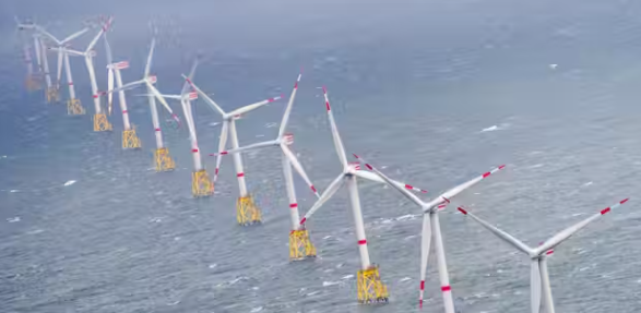
Today, more than 50 countries use metocean data to guide offshore development, especially for wind energy projects. As nations expand renewable energy, accurate wind and water information has become essential for success. From Europe to Asia, this knowledge drives safer, smarter offshore operations. What new trends have appeared in collecting and using metocean data?

Big
Data

This is transforming offshore energy by combining millions of measurements into a single, clear picture. A figure based on years of wind and water records guides smarter planning and design.

Machine learning applications

They use pattern recognition to improve forecasts. These AI systems learn from past events and predict risks more accurately, making offshore operations safer and more efficient.

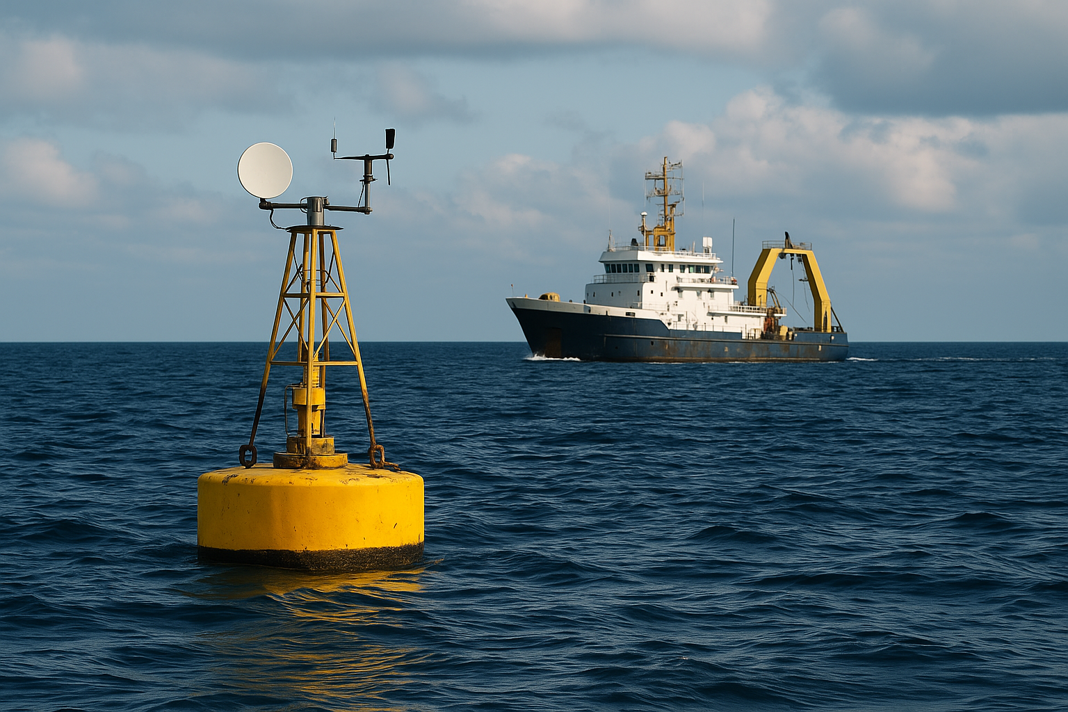
Real-time monitoring advancements

They give teams live updates on wind and water. Sensors share information instantly, helping crews adjust plans and respond well to changing situations

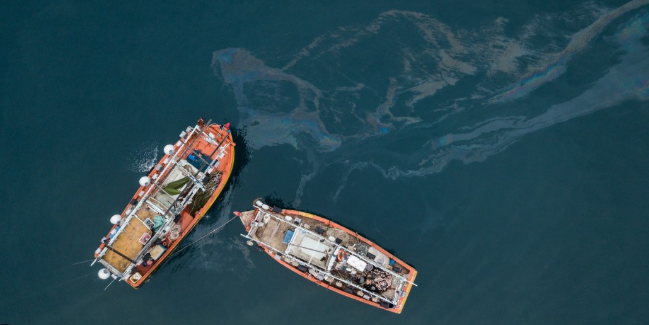
Challenges and Opportunities

Challenges always exist in integrating new technologies for understanding winds, waves, and marine environments. Gaps in long-term wind and wave records create uncertainty when predicting extreme events in offshore environments. Integration hurdles also arise because information often comes from different sources that don’t easily align. These mismatches slow decision-making and make it harder to plan safe, efficient installations. Another challenge is the need for stronger cross-disciplinary collaboration. Engineers, oceanographers, and technology experts must work together to turn raw figures into clear insights. At the same time, these challenges offer opportunities to improve tools and methods.

Sinay’s Solution for Offshore Risk and Impact Planning

Our Metocean Analytics is the next-generation platform designed to empower offshore energy and engineering teams. Built on years of expertise, our solution combines advanced analysis tools with precise hindcast data so you can plan marine activities confidently. You can define average values, extreme figures, and validation dates to create specific reports for wind, ocean salinity, temperature, and tidal currents on a global scale.

Our platform dramatically reduces weather-related risks and improves planning accuracy. With effortless access to worldwide metocean data from open, private, and third-party sources, you can integrate your own datasets for custom analysis. Open Ocean also enables you to simulate marine operations, helping your teams win tenders and execute projects more efficiently. Discover how we transform offshore planning into a smarter, data-driven process that protects the environment and optimizes performance for everyone involved.

Conclusion
From high-resolution wind measurements to AI-powered analysis, metocean data transforms how we assess impacts and manage offshore risks. As renewable energy and marine development expand, these insights will become even more critical for safe, sustainable progress. How will the future change with metocean data and better technology?
Make your Maritime Activities Smarter and More Sustainable.
© Sinay. All rights reserved.