Case Study: Successful Offshore Projects

Powered by Metocean Data
In the challenging environment of offshore operations, metocean data serves as the foundation for success. This comprehensive case study explores how meteorological and oceanographic data enables maritime industries to operate safely, efficiently, and sustainably in demanding ocean conditions.

Why Metocean Data Matters

When it comes to maritime activities like offshore energy, shipping, and coastal engineering, metocean data is crucial for predicting conditions and ensuring safe, efficient, and sustainable operations. From buoy observations to advanced weather forecasting, metocean data provides vital insights that help mitigate risks and optimize operations.
This data isn't just supplementary information—it's essential intelligence that directly impacts operational decisions, safety protocols, and long-term planning across all maritime industries.
The vital role of metocean data in Dutch offshore wind farms

Offshore Energy Production

Dutch Offshore Wind Farms: A Success Story

The Netherlands has positioned itself as a leader in offshore wind energy, with ambitious plans to increase capacity to 21 GW by 2030. This remarkable growth is made possible through strategic use of metocean data.
Dutch wind farm developers rely on comprehensive metocean assessments to:
  • Identify optimal locations based on wind patterns and energy potential
  • Design structures that can withstand extreme weather conditions
  • Schedule installation and maintenance during favorable weather windows
  • Predict long-term performance and return on investment

Key Metocean Parameters for Wind Farms

  • Wind speed, direction, and turbulence at hub height
  • Wave height, period, and direction affecting structural loads
  • Current profiles influencing foundation design
  • Extreme weather event frequency and intensity

Metocean Data Benefits for Oil & Gas

  • Accurate forecasting of severe weather events
  • Optimization of drilling and production schedules
  • Risk assessment for personnel transfers
  • Environmental impact monitoring and management

Oil and Gas: Enhanced Safety and Efficiency

For oil and gas platforms operating in challenging offshore environments, metocean data is essential for both day-to-day operations and long-term planning.
Accurate metocean forecasting allows operators to:
  • Plan vessel operations during safe weather windows
  • Prepare platforms for extreme weather events
  • Optimize maintenance schedules to minimize downtime
  • Ensure personnel safety during transfers and operations
Navigating with Confidence

Maritime Transportation

In maritime transportation, metocean data is crucial for ensuring safe and efficient vessel operations. Accurate weather and ocean condition forecasting enables shipping companies to optimize their routes, reduce fuel consumption, and maintain safety standards. This data-driven approach has revolutionized how vessels navigate through challenging ocean conditions.

Route Optimization

By analyzing wind patterns, ocean currents, and wave conditions, vessels can identify the most efficient routes, reducing fuel consumption by up to 5% and significantly lowering operational costs.

Safety Enhancement

Real-time metocean data helps vessels avoid severe weather conditions, reducing the risk of accidents and ensuring crew safety through advanced warning systems and route adjustments.

Port Operations

Accurate forecasting of port conditions enables better planning of berthing operations, reducing waiting times and optimizing port resource utilization.

Environmental Compliance

Metocean data helps vessels comply with environmental regulations by optimizing speed and route selection to minimize emissions in sensitive marine areas.

Building Resilient Infrastructure

Coastal engineering projects require comprehensive metocean data to ensure infrastructure resilience and environmental sustainability. From port developments to coastal protection schemes, this data forms the foundation of successful marine construction projects.

Design Parameters

Metocean data provides crucial information for structural design, including maximum wave heights, storm surge levels, and extreme weather conditions that coastal structures must withstand.

Environmental Impact

Understanding coastal processes through metocean data helps minimize environmental impact and ensures sustainable development of coastal areas.

Climate Adaptation

Long-term metocean data trends inform climate change adaptation strategies, helping coastal communities prepare for rising sea levels and increased storm intensity.

The Future of Metocean Data

As technology continues to evolve, the integration of these advanced systems will provide even more comprehensive and accurate metocean data, enabling better decision-making and improved safety in maritime operations.

Advanced AI Integration

Machine learning algorithms are revolutionizing metocean data analysis, enabling more accurate predictions and pattern recognition in complex ocean-atmosphere interactions.

IoT Sensor Networks

Expanding networks of smart sensors and autonomous platforms are providing unprecedented coverage and real-time monitoring capabilities across ocean environments.

Digital Twin Evolution

Advanced digital twin technology is enabling sophisticated simulation and scenario planning, revolutionizing how we design and operate maritime infrastructure.

Predictive Analytics

Next-generation forecasting systems combine multiple data sources and advanced modeling techniques to provide more accurate and longer-range predictions.

Frequently Asked Questions

Still have questions?

Contact us! We’ll be happy to help you.

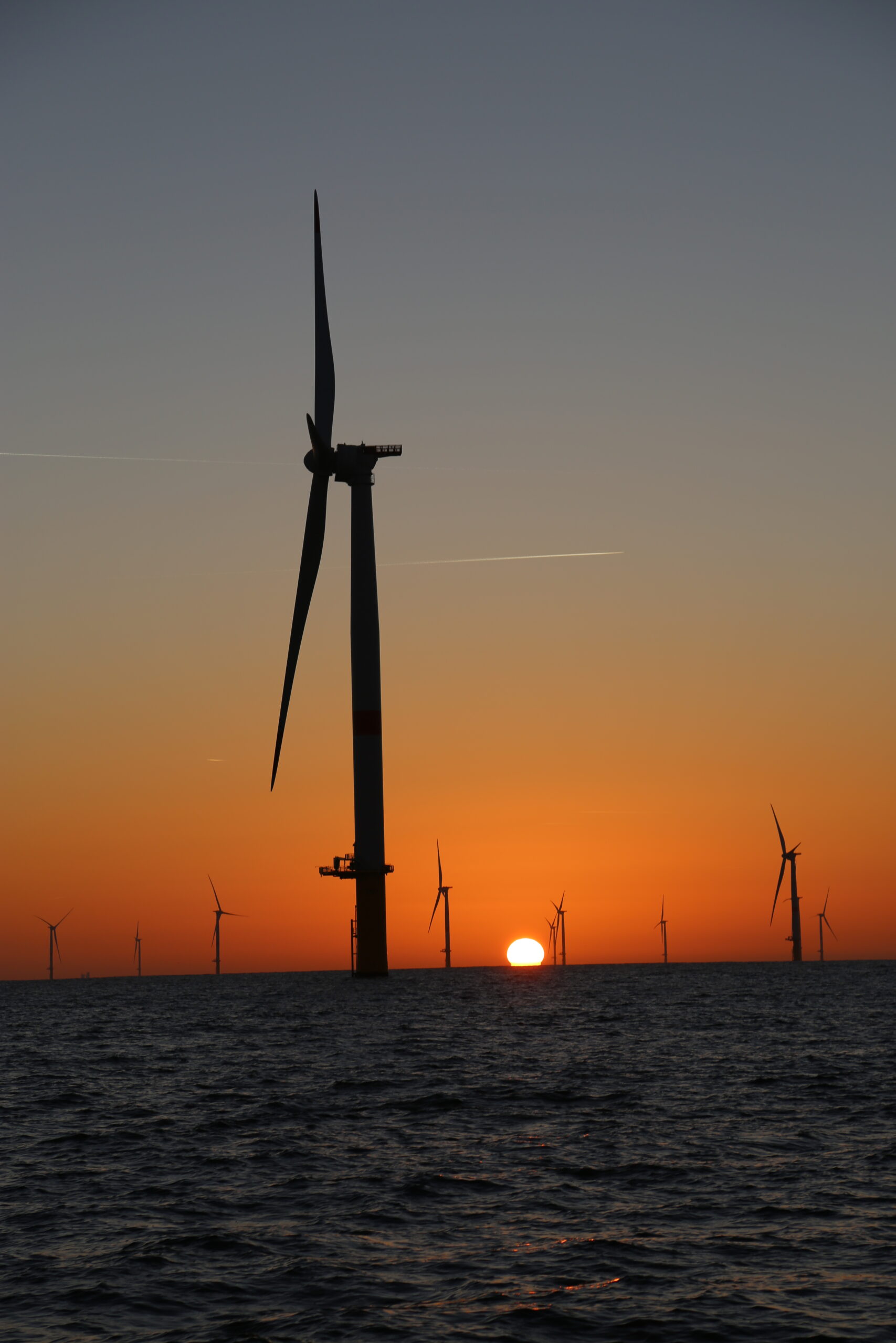
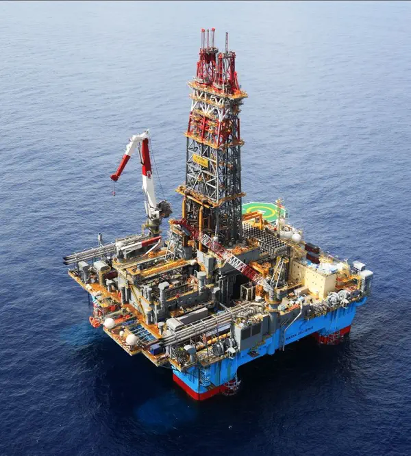
Metocean data combines meteorological (weather) and oceanographic information crucial for offshore operations. This includes:

  • Wind speed, direction, and patterns
  • Wave height, period, and direction
  • Ocean current data
  • Water temperature and salinity
  • Atmospheric pressure and air temperature

This data is essential for planning, designing, and operating offshore installations safely and efficiently, from wind farms to oil platforms.

Metocean data is fundamental to offshore project success in several ways:

  • Risk Assessment: Helps identify and mitigate environmental risks
  • Design Optimization: Ensures structures can withstand environmental conditions
  • Operational Planning: Enables efficient scheduling of activities during favorable weather windows
  • Cost Reduction: Minimizes downtime and optimizes resource utilization
  • Safety Enhancement: Protects personnel and assets by forecasting hazardous conditions

Modern metocean data collection relies on a combination of advanced technologies:

  • Weather Buoys: Floating sensors that measure wave and weather conditions
  • Satellite Systems: Provide broad coverage of ocean and weather patterns
  • Radar Systems: Monitor wave and wind conditions in real-time
  • Acoustic Doppler Current Profilers (ADCPs): Measure ocean currents at different depths
  • Environmental Sensors: Monitor parameters like temperature, salinity, and air pressure

These technologies work together to provide comprehensive environmental monitoring and forecasting capabilities.

Companies can effectively integrate metocean data through a structured approach:

  1. Data Collection Strategy:
    • Identify critical parameters for your specific operation
    • Select appropriate measurement technologies
    • Establish monitoring locations and frequencies
  2. Analysis and Integration:
    • Implement data management systems
    • Use forecasting and modeling tools
    • Integrate with existing project management software
  3. Decision Making:
    • Develop weather windows criteria
    • Create response procedures for adverse conditions
    • Establish communication protocols

Data-Driven Maritime Success

The success of offshore projects increasingly depends on the quality and application of metocean data. From wind farms to shipping routes, this information enables maritime industries to operate more safely, efficiently, and sustainably in challenging ocean environments.
By leveraging comprehensive metocean data, organizations can make informed decisions that reduce risks, optimize operations, and contribute to the sustainable development of our ocean resources.

Additional Technical Information

Advanced Measurement Technologies

Modern metocean data collection employs a variety of sophisticated technologies:
  • Satellite altimetry for wave height and wind speed measurements
  • High-frequency radar systems for surface current mapping
  • Acoustic profilers for underwater current measurements
  • Weather buoys with multiple sensor arrays

Data Integration Systems

Successful metocean operations require sophisticated data integration systems that can:
  • Process multiple data streams in real-time
  • Apply quality control measures automatically
  • Generate standardized data formats for various applications
  • Maintain data integrity throughout the processing chain

Environmental Considerations

Metocean data plays a crucial role in environmental protection:
  • Monitoring of marine ecosystem health
  • Tracking of pollution dispersion patterns
  • Assessment of climate change impacts on marine environments
  • Support for environmental impact assessments

Operational Best Practices

Key considerations for implementing metocean data systems include:
  • Regular calibration and maintenance of measurement equipment
  • Redundancy in critical monitoring systems
  • Integration with emergency response protocols
  • Continuous staff training and development

Future Developments

Emerging trends in metocean data technology include:
  • Quantum computing applications for complex modeling
  • Blockchain for data verification and sharing
  • Edge computing for improved real-time processing
  • Advanced visualization techniques for data interpretation
Make your Maritime Activities Smarter and More Sustainable.
© Sinay. All rights reserved.