Metocean Intelligence for Offshore Success

Harness the power of meteorological and oceanographic data to optimize your offshore projects and drive sustainable growth.
In the challenging world of offshore operations, understanding metocean conditions is crucial. Our cutting-edge metocean intelligence solutions provide you with accurate, real-time data and forecasts, enabling you to make informed decisions, enhance safety, and maximize efficiency in your marine projects.
Unlock the power of data-driven decision making in marine environments

Empower Your Offshore Projects with Metocean Intelligence

Precision Planning

Make data-driven decisions with accurate metocean forecasts and historical analyses.

Risk Mitigation

Identify and prepare for potential weather-related challenges before they impact your operations.

Operational Efficiency

Optimize schedules, resource allocation, and energy production with tailored metocean insights.
Access a wide range of critical metocean parameters to support your offshore projects

Comprehensive Metocean Data Suite

Wind

Speed, direction, and variability

Waves

Height, period, and direction

Currents

Speed and direction at various depths

Temperature

Air and water temperature

Atmospheric Pressure

Barometric pressure variations

Other Parameters

Humidity, precipitation, visibility
Maximize your offshore potential with data-driven insights

Benefits of Metocean Condition Studies

Improved Planning

Optimize project schedules and resource allocation

Risk Mitigation

Identify and prepare for potential weather-related risks

Cost Reduction

Minimize weather-related delays and operational disruptions

Safety Enhancement

Ensure safer working conditions for offshore personnel

Environmental Compliance

Meet regulatory requirements for environmental impact

Performance Optimization

Maximize efficiency of offshore structures and operations
Uncover the comprehensive process behind accurate metocean intelligence

How are Metocean Studies Undertaken?

Metocean data is collected through various means, including:

  • In-situ measurements (buoys, weather stations)
  • Remote sensing (satellites, radar)
  • Historical databases
  • Historical databases

The collected data is then analyzed to:

  • Identify patterns and trends
  • Calculate statistical parameters
  • Determine extreme value estimates
  • Assess seasonal and interannual variability

Advanced numerical models are used to:

  • Simulate metocean conditions
  • Fill data gaps
  • Generate long-term datasets
  • Predict future conditions

The final step involves:

  • Compiling comprehensive metocean reports
  • Presenting data in easily understandable formats
  • Providing recommendations for project planning
  • Offering ongoing support and updates

Frequently Asked Questions

Still have questions?

Contact us! We’ll be happy to help you.

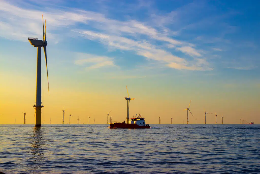
Meteorology focuses on atmospheric conditions and weather patterns, while metocean encompasses both meteorological and oceanographic conditions. Metocean studies consider the interaction between the atmosphere and the ocean, which is crucial for offshore operations.

The duration of a metocean study can vary widely depending on the project requirements, data availability, and complexity. Short-term studies might take a few weeks, while comprehensive long-term assessments can take several months to a year or more.

Metocean data should be regularly updated to account for climate variability and long-term trends. For ongoing projects, annual reviews are common, with more comprehensive updates every 5-10 years. However, the frequency may vary based on project needs and observed changes in environmental conditions.

Ready to leverage metocean data for your offshore projects ?

Discover how our advanced metocean solutions can help you make informed decisions and optimize your marine operations.

Understanding Metocean: Comprehensive Guide

Origins of Metocean

The term "metocean" originated in the oil and gas industry during the 1970s and 1980s, when offshore structures like oil platforms became more prevalent. The need to understand both meteorological and oceanographic conditions led to the combination of these two fields, giving birth to metocean studies.

Importance in Offshore Wind Energy

In the context of offshore wind energy, metocean plays a crucial role. Wind farm developers need to understand the wind resource at their proposed site, but they also need to know about waves, currents, and other oceanographic parameters that can affect the design, installation, and operation of wind turbines.

Metocean Parameters

Metocean parameters include wind speed and direction, wave height, period and direction, current speed and direction, water level, air and sea temperature, air pressure, and humidity. These parameters are measured over time to understand both average conditions and extreme events.

Data Collection Methods

Metocean data can be collected through various means, including in-situ measurements (e.g., weather buoys, fixed platforms), remote sensing (e.g., satellites, radar), and numerical modeling. Long-term historical data is often combined with short-term site-specific measurements to provide a comprehensive understanding of metocean conditions.

Applications of Metocean Data

Metocean data is used in various stages of offshore projects, including:
  • Site selection and feasibility studies
  • Engineering design of offshore structures
  • Planning of marine operations (e.g., installation, maintenance)
  • Weather forecasting for day-to-day operations
  • Assessment of extreme conditions for safety and risk management

Challenges in Metocean Studies

Metocean studies face several challenges, including:
  • The need for long-term data to capture seasonal and inter-annual variability
  • The complexity of interactions between different metocean parameters
  • The impact of climate change on historical data relevance
  • The high cost of data collection, especially in remote offshore locations

Future of Metocean

As offshore industries continue to grow, particularly in renewable energy, the importance of metocean studies is likely to increase. Advances in technology, such as improved satellite capabilities, autonomous measurement devices, and more sophisticated numerical models, are expected to enhance our ability to understand and predict metocean conditions.

Conclusion

Metocean studies are an essential component of offshore project planning and operations. By providing crucial data on meteorological and oceanographic conditions, they enable safer, more efficient, and more sustainable development of offshore resources. As our understanding of metocean conditions improves, so too will our ability to harness the vast potential of our oceans.
Make your Maritime Activities Smarter and More Sustainable.
© Sinay. All rights reserved.